Climb the Cascades Fundraiser: Mt. Baker Trip Report (Volcano 3/5)
This trip supported my 2022 Adventure Fundraiser for The Cairn Project. I climbed 5 volcanic peaks to raise grant funding for female youth-serving organizations to expand access to outdoor learning and experiences! This was the donation page.
Shout out to LOWA boots for supporting this project– my feet were truly saved on this mountain by my Alpine Expert pair.
Mt. Baker Bailed Summit Attempt via Park Glacier Route: July 16-17, 2022

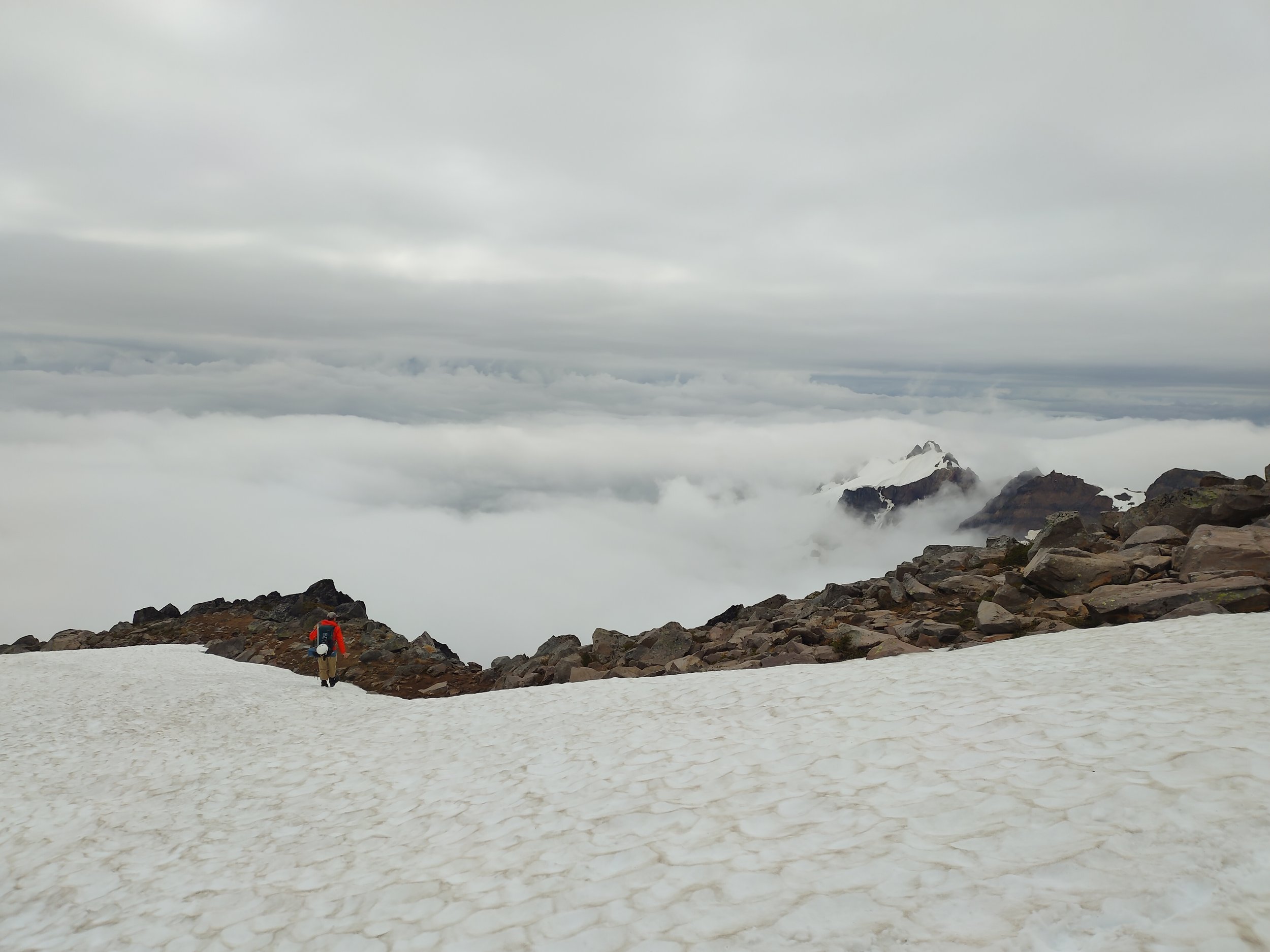
The best view I got on Mt. Baker.
About this route
Mt. Baker in the North Cascades of Washington has the second heaviest glacier cover in the Cascades (after Mt. Rainier), holding more snow and ice than all the other Cascade volcanoes (minus Rainier) combined! With 11 glaciers descending from the upper mountain and another two detached and on its lower slopes, this volcano is a climber’s dream.
My group had our sights set on one of the lesser-climbed routes on the mountain. The Park Glacier route is the longest of the northern approaches, starting from Artist Point near the ski resort. Most climbers choose the Easton Glacier route since it’s the most straightforward and a good place to learn glacier skills. I was excited to spend time in a less-visited area of the backcountry.
The Park Glacier route starts off along the Ptarmigan ridge, cuts through Kiser Camp and passes The Portals. We planned to gain the saddle above the Portals, which I believe may be named the Glacier Saddle, where the Rainbow, Park and Sholes glaciers merge. (It’s hard to find beta on the internet, so correct me if I’m wrong!) Then we’d drop down to the Sholes and Rainbow Glaciers, go around the Portals and finally up the Park Glacier.
We planned to descend via the Easton Glacier after a successful summit (which is the most popular route), making for a varied point-to-point climb.

A brief view beneath Ptarmigan Ridge.
My climbing team
I joined a fun group of trail runners and endurance athletes for the weekend. We hoped– conditions depending– to fastpack the first day up to camp, then get an alpine start on a summit push the next morning. A couple folks hadn’t been on a glacier before, but all had high levels of fitness, so we sought a hybrid fastpack/mountaineering/skills learning and practice weekend.
My personal intention for this peak was twofold: I wanted to attempt a route and mountain that would help me expand my mountaineering skills, specifically with ropes and reading terrain in heavily crevassed areas. I also wanted to test out packing lighter than usual (in the name of fastpacking) and having a more “minimalist” mindset compared to usual. I still carried gear in my pack that I didn't necessarily need– or items that are heavier than their more expensive counterparts– but I wanted to experiment a bit and see how I’d fare with things like a “homemade” bivy and cold soaking food.

The team! Minus me.
Day 1: From Artist Point to a camp past the Portals
Saturday morning, the team left our lush camping spot at Silver Fir Campground along the Nooksack river. The road to Artist Point had just opened several days beforehand, leading me to think we’d have a lot of snow left on the trail.
Sure enough, the parking lot had tons of snow, big steep walls surrounding it. (On the way out the next day, I saw a handful of families sledding around it.) The late snowpack this year is awesome!

Artist Point parking lot mid-July 2022!

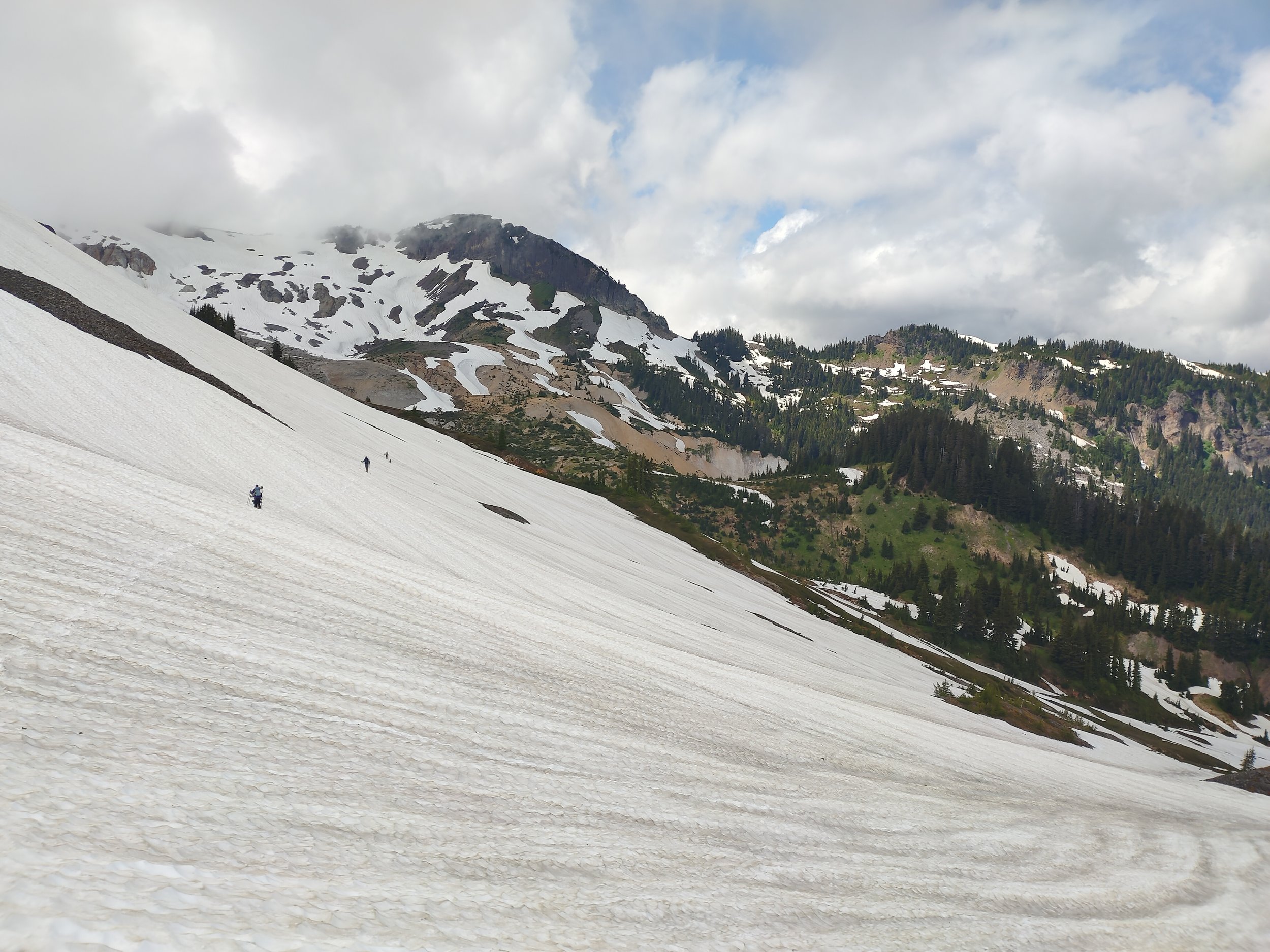
Most of the climb looked similar to this.
But the visibility (or lack thereof)? Not so awesome. It was near whiteout conditions as soon as we arrived and started to get going. No wind, no real precipitation, but we were in dense cloud.
We started off by meandering a bit through forested slopes until we made it out to the snowfields. There were absolutely no views, but we did get some nice patches of watermelon snow and found a marmot skull with teeth intact.
From the get-go, traction was iffy and I found myself wishing I’d brought a second pole. (I typically have one pole and one axe, carrying one in each hand, though my axe was still stowed at this point.)
As we dropped into the snowfields, there was a bit of a precarious slope where we navigated close to the border of the rock and snow. In the middle of it, while attempting to dodge the hole between rock and snow, I lost my footing and slipped. I had to self-arrest with my single hiking pole, since my ice axe was still strapped to my pack. Thankfully, that stopped me, but it did snap my pole in half. We taped two ends together to get some semblance of a functional pole, and it got me through for the next day and a half.
After that, we all practiced self arrest skills on a steep slope with nice, flat bottom. After sliding down, we left the summer route of The Ptarmigan Ridge to join the “winter route” and crossed some lower terrain heading southwest. Both sidehilling and kickstepping felt good. The snow was perfect for kick steps; it was firm without being icy, we didn’t sink in too far and didn’t need crampons at all.

Below Ptarmigan Ridge
Soon, we had to gain the ridge again with some steady but smooth uphill, then walked along the ridge– a nice chunk of which had no snow and some nice greenery instead. (Of course, still no views.)
We dropped down a gully and continued through to Camp Kiser. We briefly considered camping there instead, since we didn’t know what to expect with conditions at Portals High Camp, but figured we’d use our energy and daylight to continue on.
Shortly past Kiser en route to the Portals, we had a short but nervewracking traverse. With the low visibility, there was one part of the slope beneath us that we couldn’t see, so we wanted to play it safe and go around in case there were any hazards. Good thing we did go the long way around– the next day, we could see the rocks and cracks awaiting had we simply gone downhill. It was definitely a no-fall zone for some of our movement there.

Runnels along the snowfield.
So instead, we had a slow traverse and downclimb until we could safely descend into the glacier. We approached the Portals and gained a couple switchbacks up to them. Again, we thought about making camp, but for a group our size there really wasn’t enough room for everyone to get a half-decent sleeping spot, so we pushed on. We carefully switchbacked the slope through near-whiteout, getting pretty tired after a longer, more difficult day than expected.

A very brief view while standing on the ridge between the Portals!
We came to some exposed rock with running water, where I filled up my bladder and bottle. I was a bit uncomfortable here since it looked like a steep cliff where you’d want careful footing– again, we couldn’t see what was below through the cloud, but it looked like another no-fall zone. Seeing it a bit better the next morning confirmed some iffy rocks and cracks below the cliff.
Visibility was very shut down at this point. We aimed for camp and tried to get there by going down a ~45 degree slope (which freaked out some of the new folks, and was annoying in my tired state), and unfortunately, we ended up cliffed out at a pretty sketchy cliff edge at the bottom.
Once we were all together at the bottom and able to communicate again, it was clear that the safest way out would be to reverse the way we spent so much time coming down. Trying to cross the rocky cliff would’ve been very high-risk and high-consequence– clear even in low visibility. This was probably the group’s morale low point.
At that point, as I carefully sat on the sketchy cliff, I came to total peace with the likelihood that we wouldn’t summit this trip. In the short-term, I just wanted us to get somewhere safer, find any camp and take care of our bodies. For the whole trip, I wanted the new folks to leave feeling inspired to mountaineer again, not to feel too freaked out over our spookier options and rough conditions. Between the way higher than normal snowpack and the whiteout, we were way slower than expected and didn’t bring as many calories as we would’ve for our Day 1 efforts.

Some Type 2 fun past The Portals.
We backtracked up the slope and just to the west found basically a pile of rocks off the snow that we figured we could turn into camp. Many hands make light work, and we cleared out a bunch of rocks and stacked them as windwalls for our bivies. We had just enough room for everyone to spread out and lie down in a bivy.
Deciding to Bail
We’d arrived at camp around the time we’d hoped to be asleep. Tired but fed, we discussed the next day’s objective. Several people were pretty against continuing on and wanted to return the way we came to the trailhead. Others were pretty nervous from the day’s events and felt scared to even go back the way we came if conditions didn’t improve. We discussed all our options and agreed that the weather would decide for us whether or not we’d push for the summit.
We decided we’d wake up at 2 AM, 3 AM and 4 AM to check for visibility. If we could see mountain or stars, game on! If not, back to bed. 4 AM would be our absolute last call in order to make it up and back home in time. But all through the night, it looked like we were inside a ping pong ball. We bailed on the summit bid and slept in instead.
Waking around 7 AM, we were greeted with brief and intermittent mid-distance views! Exciting! Seeing things other than white fog, woohoo! We could see the glacier and intended route, but we never saw the summit.
I had a slow morning of cozy bivy time and lots of coffee. (That was one thing I wasn’t going to pack light on; I had my whole coffee system ready to rock.)

My cozy spot for the night.

My best coffee system.
Day 2: Back to the trailhead
When we finally started moving after breakfast, we returned down to the cliff with the running water and were able to see what was under us the night before. We decided to traverse a couple dozen yards using hands and feet, then downclimbed toward the flats of the glacier. At the bottom, we praticed our rope skills, then roped up to walk across the glacier. I was in the back of my all-women’s rope team, and we were strong! We practiced arresting a fall and moved at a faster pace than the whole day before, which felt great.

Delayering in the warmth.

I whipped out the camera every time the clouds parted a bit.
We climbed up out of the glacier and gained the ridge, where we unroped. Through the Kiser and Ptarmigan Ridge areas, we chose to navigate through the snowfields this time instead of going through the dirt and gully of the day before. Since visibility was improved (though still not great), we could see more options and choose the best one, instead of picking a single safe-looking one we could see and trying it until it wouldn’t go. This helped us move a lot faster (and happier) than on Day 1.
After the ridge, we descended down then traversed back to the place where I’d slipped and broken my pole. Again, increased viz helped us choose a better line; this time we were able to avoid the spicy spot close to the rocks where I’d slipped, and instead had an easy switchback out of there.

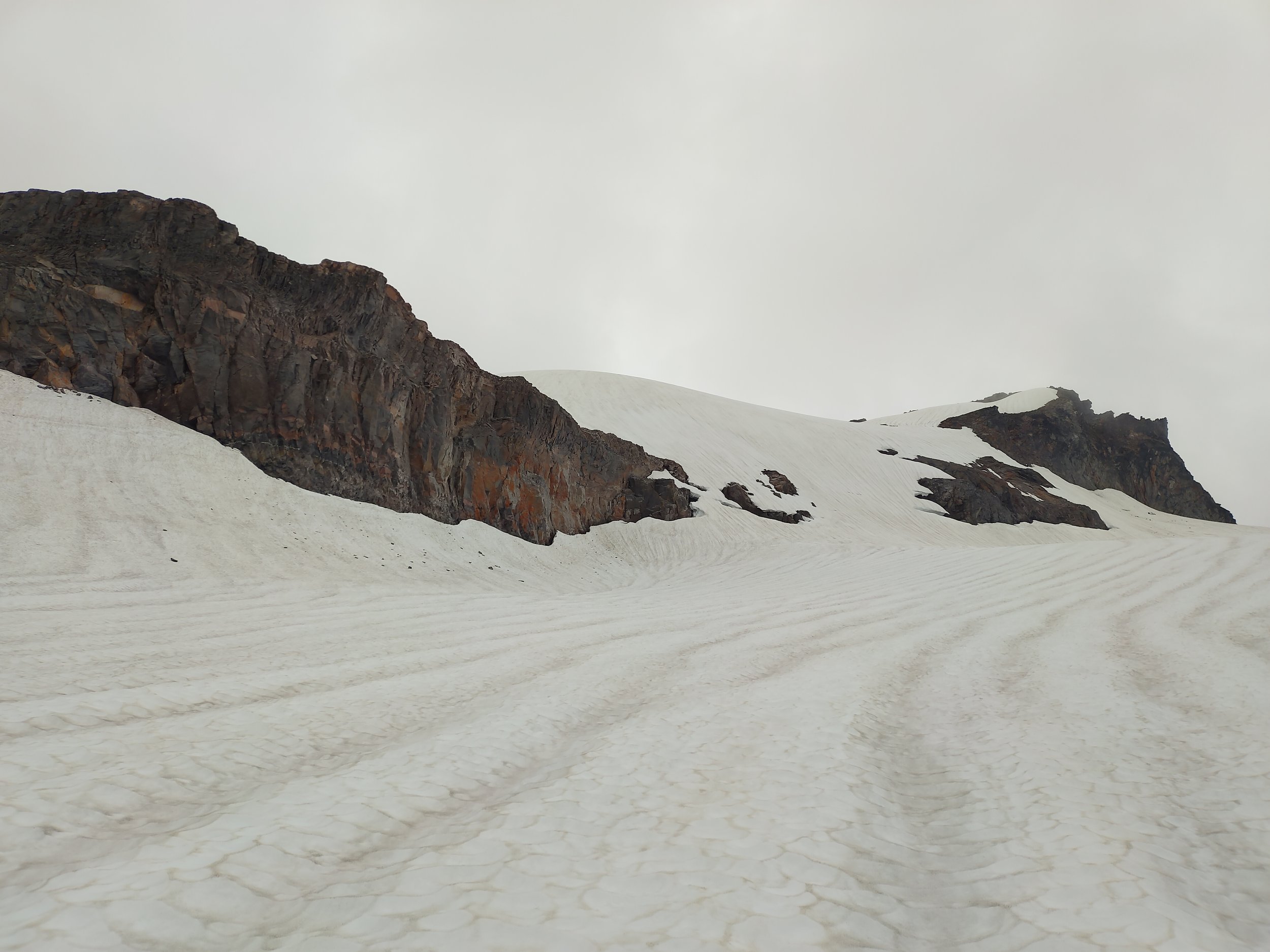
In the center-right of the photo, just to the right of the big rock cliff, you can see the rocks and small cracks we ended up traversing above the day before. We cut straight across the glacier this time, which gave us views on what we’d done the day before.
From there, we quickly reached the Ptarmigan trail and had intermittent dirt patches between the snow, avoiding a few hollow patches. This was a breeze, and we delighted in the two marmots nearby whistling at us.
We still never got full visibility. I never once saw the summit or the upper reaches of Mt. Baker in the whole two days.
Thankfully, we had a fantastic shuttle helper who greeted us with soyrizo tacos and watermelon margaritas at the trailhead before the drive back to Bellingham.
In the end, no fastpacking was had– just mountaineering. Although we never needed crampons, I held onto my ice axe 90% of both days.

Some cracks.
Lessons and Reflections
Remember my intentions for this trip? I definitely met them.
First, I stepped up my game a bit in alpine skills, and having more ropes practice was fantastic. This was the worst viz I’ve had in the mountains, so I got even more than I bargained for, but I feel like I learned a ton and got to finesse my existing skillset.
Second, my less-and-lighter gear method was successful. I stayed perfectly warm in my bivy: a cheap foam pad on the rocks, a reflective tarp on top of it, then an air pad and sleeping pad layered on top of the tarp. I folded the tarp in half like a blanket over me and used a rock to hold it shut in the breeze. So cozy! I also had heated up my Nalgene with boiling water for my wet and chilly feet at the bottom of my bag. After they warmed up, I was quite comfortable.
I did have one more gear mishap in addition to my broken-then-fixed pole: Unfortunately, my sunglasses lenses ended up extremely scratched (probably from me rubbing the foggy lenses), and at many points I couldn’t tell if my lenses were just blurred or if it was just such a whiteout in front of me that obscured my vision. (I think it was both.) That was annoying enough to make me commit to buying glacier goggles– I’d gotten away with Goodrs and hats until that point.
All in all, this was a worthwhile exploration. I love that I got to experience a route that most people don’t pick, even if I didn’t do it in its entirety. I know I have the skills to climb Easton, but the learning experience of somewhere less traveled was thrilling.
If I get the chance to join a team for any route on Baker this summer, I’d love to join and get another summit bid. But even without getting to the summit, I learned a lot and am grateful for it all.
I’m pumped to go back and actually SEE the mountain sometime.

So grateful for these little random minutes of scenery!

Excited to come back, hopefully soon.
If this gave you any insight or inspiration, would you be able to donate $5 to my Adventure Fundraiser for The Cairn Project? 100% of your donation will go towards getting youth girls on life-changing outdoor experiences!
This trip occurred on land stolen from Indigenous peoples, including those of the Lummi, Nooksack, and Upper Skagit. I am grateful for the stewardship of these people of their beautiful land.
