
Climb the Cascades Fundraiser: Mt. Rainier Trip Report (Volcano 4/5)
This trip supported my 2022 Adventure Fundraiser for The Cairn Project. I climbed 5 volcanic peaks to raise grant funding for female youth-serving organizations to expand access to outdoor learning and experiences! This was the donation page.
Mt. Rainier Summit via Disappointment Cleaver: July 23-24, 2022

Sydney was an awesome team leader, and she has her own Adventure Fundraiser going on— check it out!
The Backstory
I’d had my eye on Rainier for years, but I figured it’d be another year or two before I attempted it. Finding experienced, trusted climbing partners is hard, I don’t have a ton of ropes or crevasse rescue experience, and if I hired a guide, it’d cost thousands. Although I felt physically and mentally ready for an experience on Rainier, I assumed I’d have to wait until at least next year for an accessible opportunity to come my way.
But through the magic of The Cairn Project, I connected with a couple folks who planned to attempt the climb that weekend and wanted a third member, and after chatting with our lead, I joined the team just three days before the big day! I’m incredibly grateful for this opportunity that practically fell into my lap. It goes to show that the more you put yourself out there, the more comes your way.
My intention for this climb was to feel comfortable being on a rope team and understand what to do in the event a team member fell into a crevasse (not to mention, to test my skills on Washington’s highest peak!), so I met Sydney Friday evening to practice crevasse rescue skills. Then Phil joined us so we could sleep in our cars in an Ashford campground that night. Saturday morning, we carpooled to the National Park and got ready to move.

Our team of three posing for the “before photo” on the Muir steps at Paradise.
Paradise to Camp Muir
We left the Paradise parking lot (already nearly full) before 9 AM and headed up the Skyline Trail towards Camp Muir. The first stretch is paved, soon transitioning to a dirt, rock-lined path with a good amount of rock stairs. The mountain loomed over us the whole time, with crystal clear blue skies. We heard a couple distant small avalanches and watched a rockslide! I knew there’d be no screwing around on this mountain.

Headed up the Skyline Trail from Paradise. The climbing route starts out of frame towards the right.
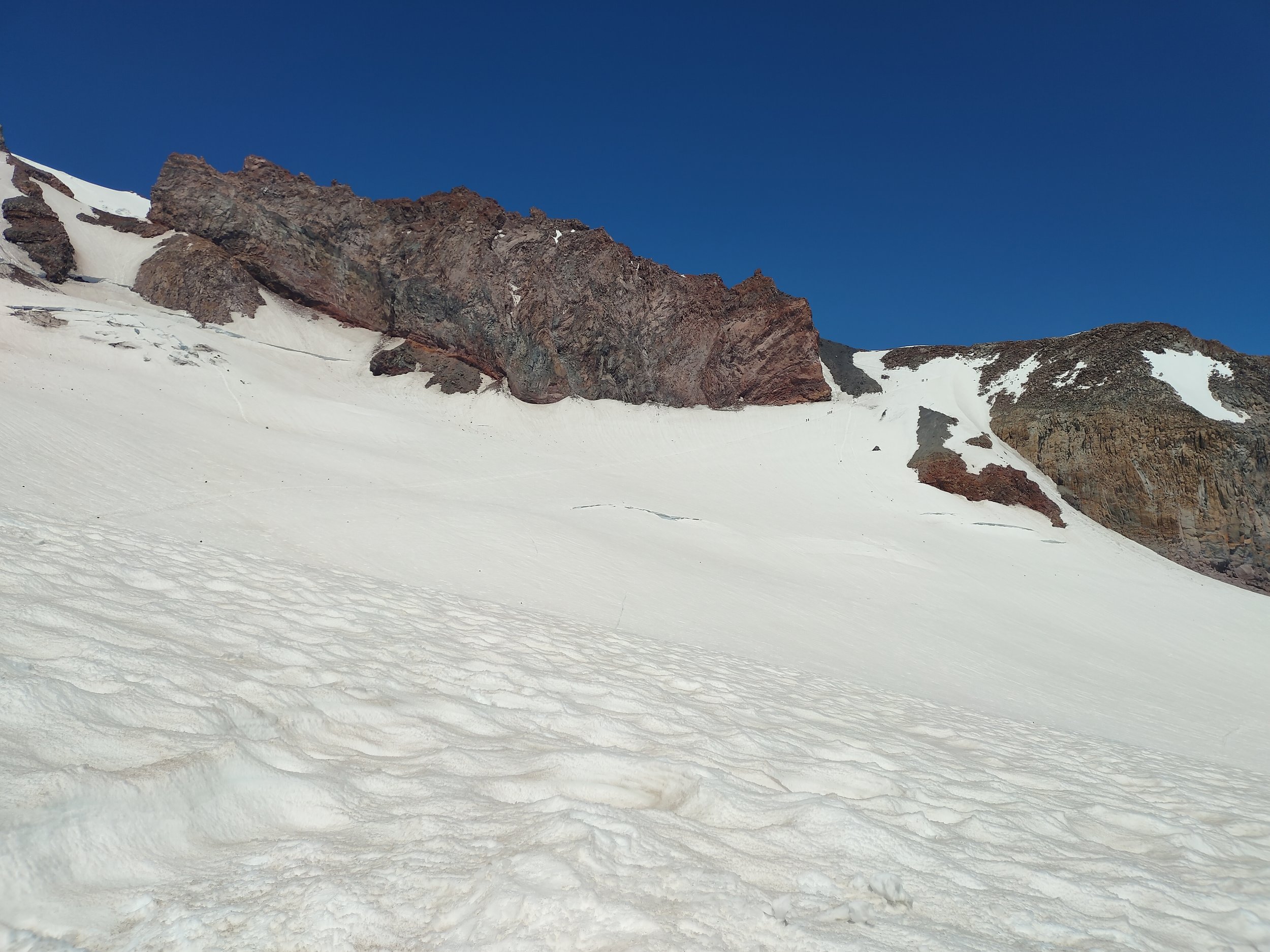
Soon, we reached the bottom of the snowfield. From there, we climbed pretty directly up, with eyes set on the rocks that sit below Camp Muir. Camp Muir and the Muir snowfield are surrounded by the Nisqually Glacier to the west, the Cowlitz Glacier to the north/east, and the Paradise Glacier to the south/east. Nice views of Adams, Hood, St. Helens, the Goat Rocks and the Tatoosh Range greeted us from the south. There were a lot of day hikers and skiers enjoying it, too!
The approach was toasty, but I forced myself to stay totally covered to protect my skin from the sun. From car to camp was about 4 hours; we kept it fairly relaxed but the steepness in the heat still made it a bit of a workout.
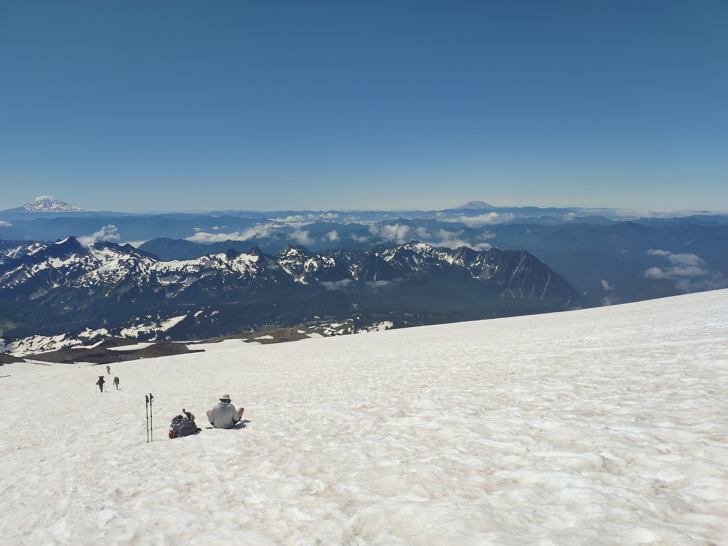
View from a rest break headed up the Muir snowfield. Mt. Adams is the left, Hood faintly to its right, and Mount St. Helens on the right.
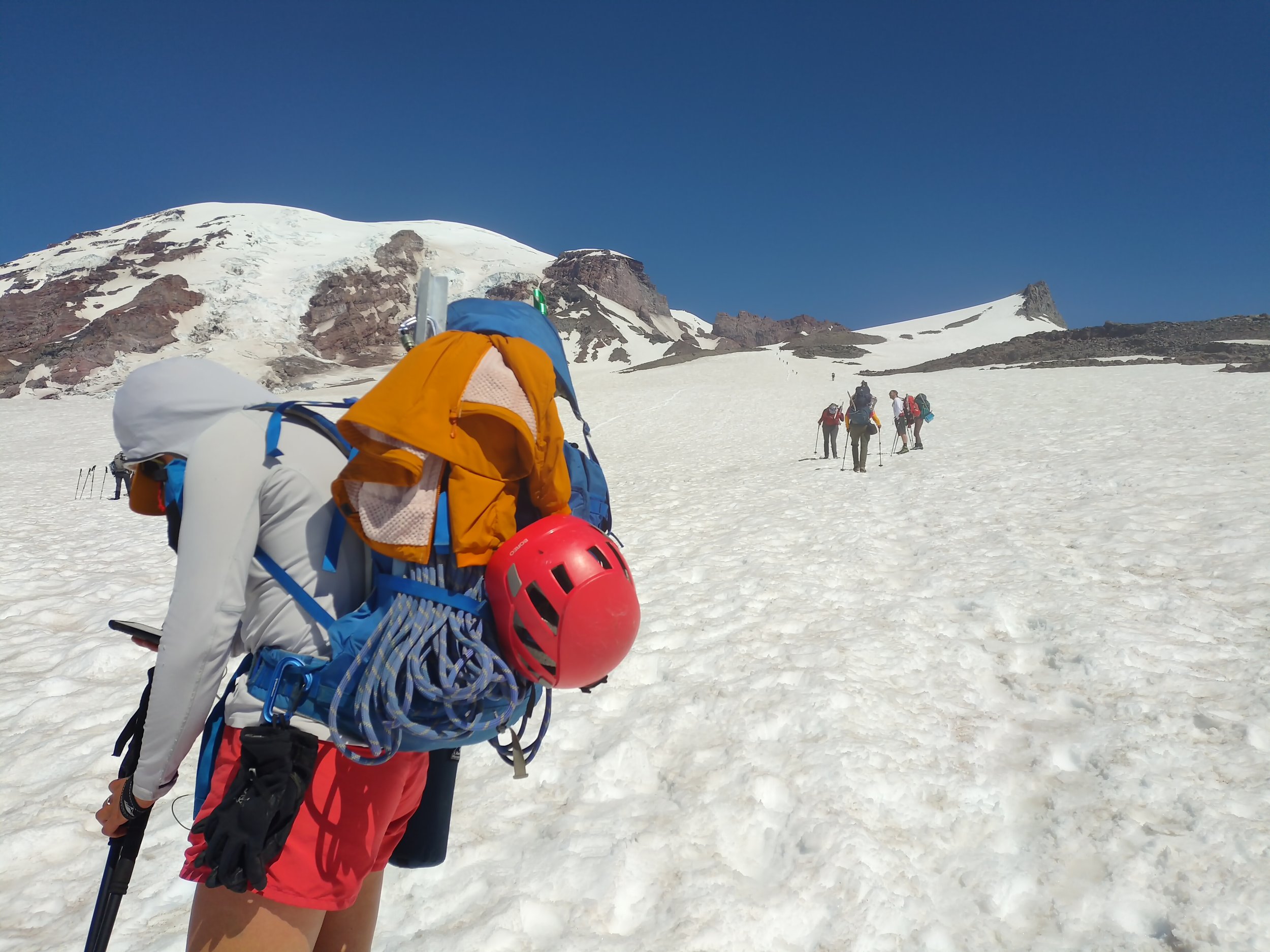
You can see the line of climbers about to thread their way between the rocks just right of photo’s center.
When we arrived at camp, we found two tent spots just next to the route and began camp chores. We melted snow for hours to get enough drinking water– a big garbage bag came in handy to store snow (and worked a bit as a solar melter)!

Looking down from the bathroom area at Camp Muir towards the campsites.

My tent! I recommend deadman anchoring your tent stakes. in case of wind. Every year, at least one tent rips away and flies down into a crevasse.
Around 4:30pm, we went to “sleep.” But I did not sleep. Despite having spent countless nights sleeping outdoors in all types of environments, I still struggle with sleeping the first night in a new place. Plus, the sunlight was so bright even through the tent walls, and Camp Muir was a bustling place, echoing with voices of other climbers throughout the day. We pulled our buffs over our eyes and tried to enjoy horizontal time.
From Camp Muir, you can see the faint bootpack going up across the Cowlitz Glacier towards the top of Cathedral Gap.
Around 6pm, as I continued to pretend to sleep, the ranger called for everyone’s attention and briefed the entire camp on conditions and weather. I thought that was awesome for the Park Service to do, even if it cut into “sleep.” After that, people quieted down a bit, but conversation and new arrivals continued past 9pm. Bring earplugs! I wish I did!
Camp Muir to Summit
Our alarm went off at 11pm, and we got dressed and prepped for a summit bid. I, naturally, had to make coffee and a true breakfast, which was iffy in the wind, but I warmed up my hands on my Nalgene after. We donned our harnesses, crampons, helmets and packs, then connected to the rope. We left camp at 11:45pm, among many other climbers, but potentially within the first half of the climbers that day.
We started off with the first push across the Cowlitz Glacier under the Cathedral Rocks with no stopping. Rock fall here can be dangerous, even more so as the day warms, so we kept moving. Thankfully, it didn’t feel as steep as it appeared in daylight, perhaps due to my no-sleep stupor. Amid the metronome crunch of our crampons, Sydney’s voice crackled through the radio, “I’m ready for that beer.”

Daytime view from Disappointment Cleaver. Ingraham Flats camp is right of center of photo. I didn’t take any photos in the dark.
The crescent moon skimmed the horizon as we walked under a blanket of stars. As we approached Ingraham Flats camp, it was hard to tell the difference between the stars and the camp’s lit up tents! The mountain gracefully blended into the constellations. I entertained myself with my usual alpine start inner dialogue about dream business ideas, people I love and places I want to visit. I knew that I’d have to stop my daydreaming soon in order to focus on the route– within a mile, we already had to take a big step across a crevasse.
Past Cathedral Gap approaching Ingraham Flats, we ran into a lot of traffic. There were a lot of rope teams out, with folks coming from Muir and people starting at Ingraham. We had to wait a bit, and used the time to snack and hydrate. We passed a couple teams and continued through the Icebox and Bowling Alley to the start of the Disappointment Cleaver, what many call the crux of the climb (though thankfully, the DC was in good shape for this time of year).
This spicy section of the route involves 1,200 vertical feet of climbing, with plenty of loose rock, ash and dust. “Cleaver” isn’t used widely outside of the Pacific Northwest, but it’s used to describe the rock ridge that separates (“cleaves”) two glaciers, in this case the Ingraham and Emmons Glaciers.
At the bottom of the DC, we immediately ran into bottleneck. We patiently waited for teams to move through ahead of us, trying to keep warm and maintain stable footing. There were hand lines for a lot of the DC, which were appreciated greatly on the way down, but were harder to use and access with so many people on them at once. As soon as we safely and kindly could, we passed several rope teams. (My team seemed to move faster than average; no teams passed us the entire day, but it felt like a sustainable pace, and there were only three of us which made for smoother travel. We all seemed happy about that.)
After we gained the DC, we continued on all snow, which was welcome after some annoying rock. There were a handful of crevasses to walk over, and one that we opted to go around its end (for the ascent only). There was one that housed a plank to walk over it, and one that had a ladder prepped for likely later in the week when it warmed up and opened more. Other than navigating those, the climbing was fairly straightforward. Steep switchbacks, firm bootpack and good team communications.
As we ascended, I could feel the altitude a bit. I had light nausea (though not enough to stop me from eating) and occasionally a little bit of headache, but more than anything it’s just more tiring to exert yourself at that elevation! Pressure breathing really helped me here: inhaling deeply then forcefully and quickly exhaling all the air out of your lungs, almost whistling it out through tight lips. Sydney recommended it– and I’ve read about it– and it truly helped me keep going.
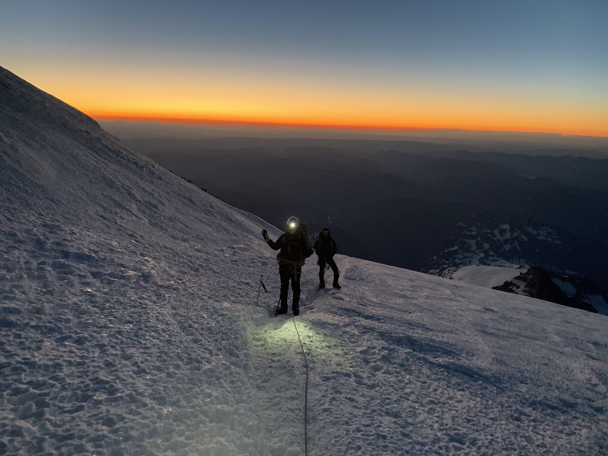
Sun about to rise within the last ~500’ vertical. Freezing level was 1t 14,000’ that morning.

Crossing the crater just before sunrise.

Headed toward the Columbia Crest on the crater rim.
As we got closer to the summit, we began to see that pre-dawn glow. The horizon slowly turned that vibrant orange color you only see in that alpine setting– if only we could bottle it! We figured we’d get to the summit just by sunrise, which we did– lovely timing.
We arrived at the crater and traversed it to get to the Columbia Crest, the high point of the crater rim and the true summit, where we immediately got to watch the sun rise. We stood on the snow-free zone after passing a couple fumaroles, then signed the register. There were a handful of climbers up there, with many more minutes to hours behind us. It felt special knowing that only half the climbers who attempt the summit make it there– never take it for granted. It took us about 5.5 hours from camp to summit.

On the top of Washington for sunrise!
Summit to Camp Muir
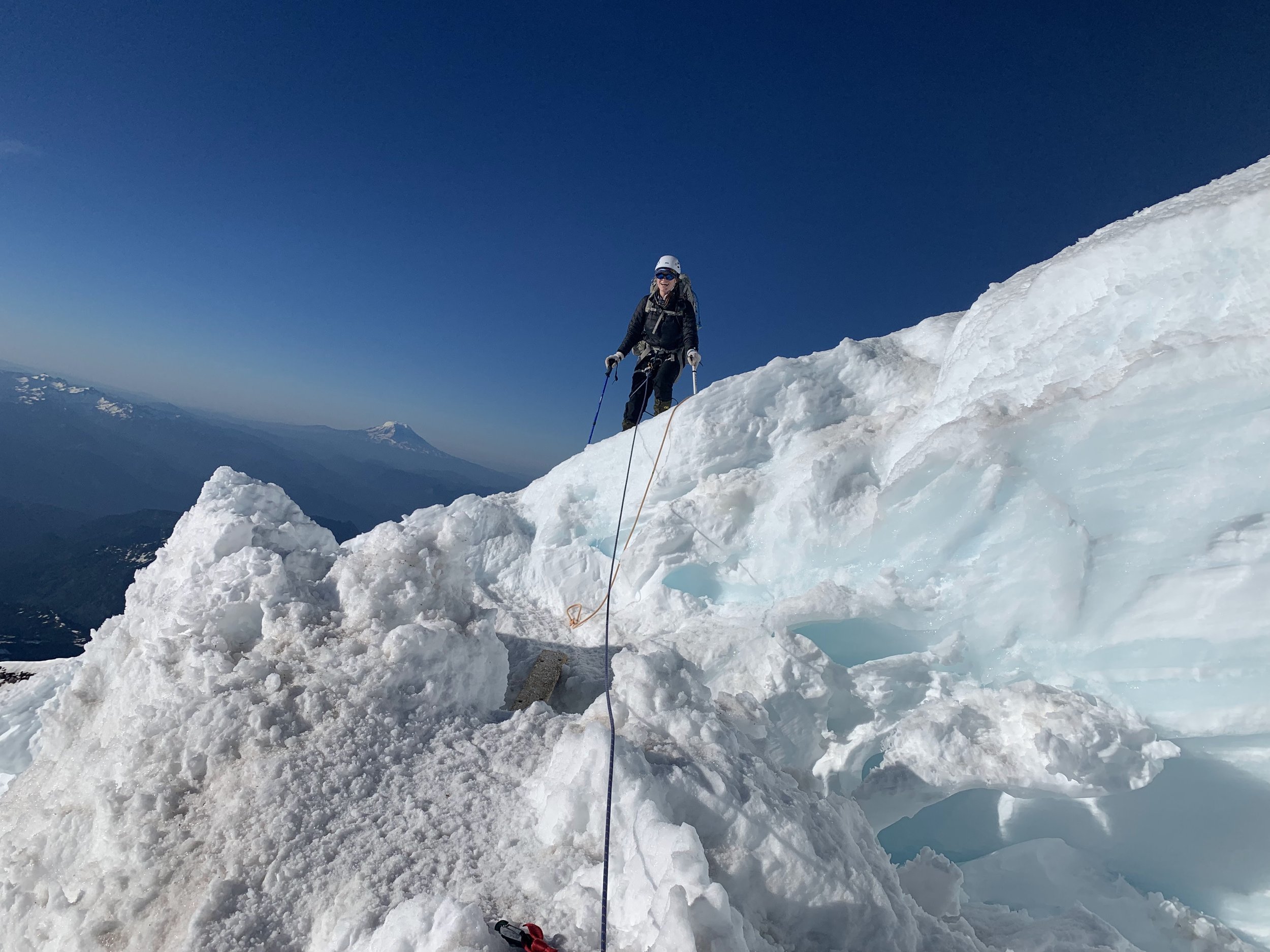
I knew the way back down could be harder in some ways, and it took me a bit to not be so awkward with the ropes going downhill on switchbacks. It was fascinating to see in daylight what we’d crossed through overnight. A lot of it looked far scarier than it had when all we could see was with our headlamps! But it’s truly awe-inspiring to get a close-up look at glacier features and cracks.
My best coffee system.
As we got to the top of the DC, we decided that logically, the best way to keep us all safe would be to detach from the rope though most of it and to use the hand lines where needed. It felt more comfortable than I expected– much easier in daylight and when there’s not a million others going the same way. We re-roped at the bottom and continued down to camp, avoiding active rockfall and hustling safely where we could.

Seemingly bottomless!

Crevasses were straightforward to cross or avoid.
Even though I was exhausted from not having slept in a couple days (I couldn’t sleep in the car Friday either, womp womp), I felt strong and satisfied with our hard work. From summit back to camp took us about 2.75 hours.

View nearing the bottom of the Disappointment Cleaver, with Ingraham Flats camp left of photo.

Little Tahoma on the left while passing through Cathedral Rocks.
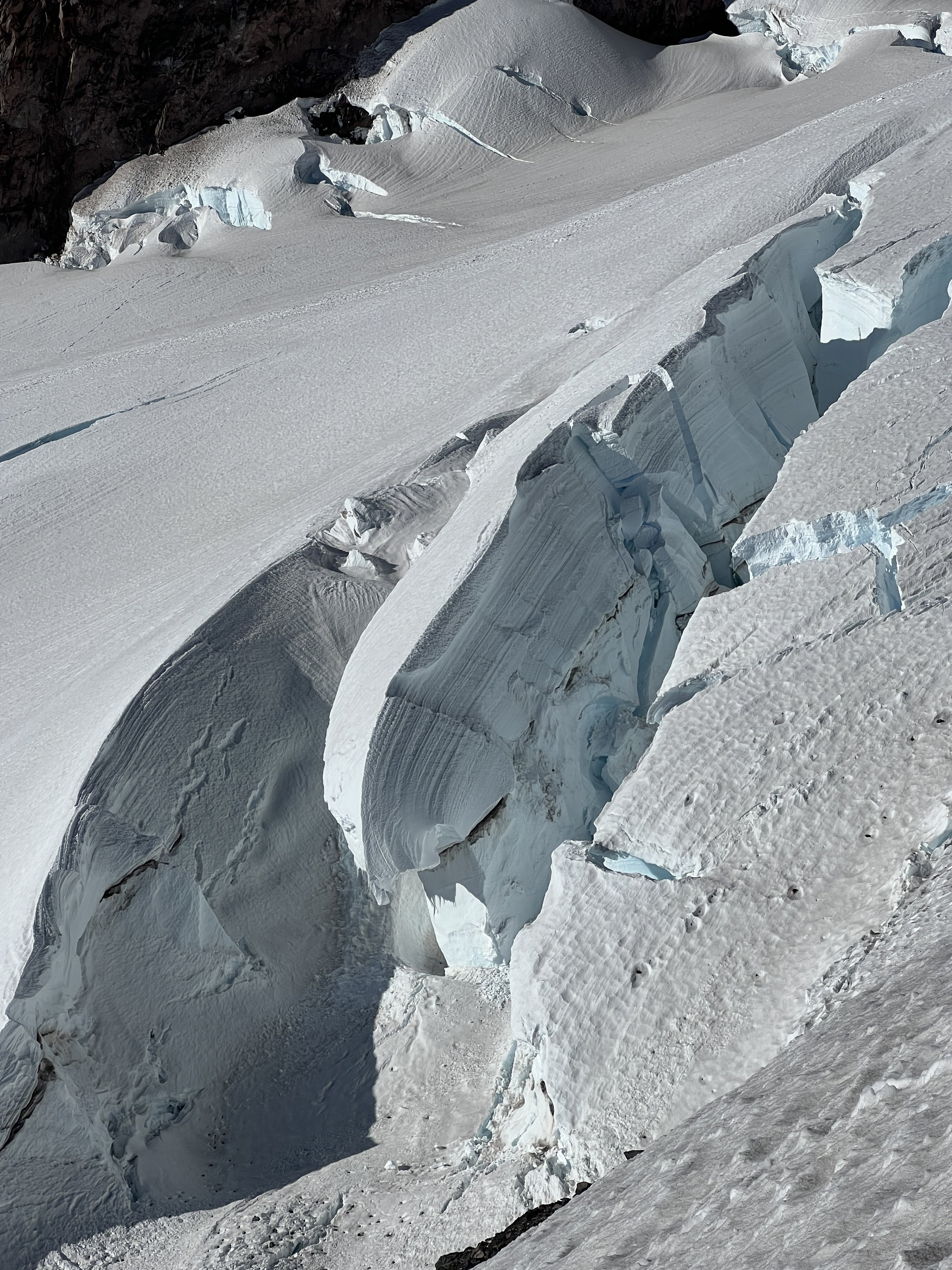
I don’t remember a lot from my BS in Environmental Science, but I think this might be a “calving” glacier?
Camp Muir to Paradise
When we arrived at camp, we decided to lie down for an hour. I couldn’t sleep, of course, but being horizontal and knowing most of our hazards were over with felt nice. After an hour, I could tell I’d just get hotter and more dehydrated if we waited much longer, so we packed up and said goodbye to Camp Muir.
I’m (some would say surprisingly) awkward with moving quickly downhill on snow, so lucky for me, there were some great glissade chutes down the snowfield! And, I’d kept a garbage bag in my pack. Woohooooo!
As we got down to the Skyline Trail, we found tons of visitors enjoying the park, including families from across the world. Everyone was out enjoying the beauty of the region, and some of them were entertained by us and the idea of getting to the summit. It was cool to see folks so interested! We arrived at the car almost 2 hours after leaving camp.

Myself, Sydney and Phil, all smiles after returning to Camp Muir from the summit before headed back down to Paradise after lying down for an hour.
Stoked!
This entire trip was very well-done. I felt like I’d progressed in all my alpine skills, let alone getting more familiar with anchors, mechanical advantage and rescue skills. I’d learned aspects of these systems in Search and Rescue and Swiftwater Rescue, but found that Sydney helped me understand it way more. So thankful for her!
I’m thrilled to have had this surprise trip on one of the climbing community’s most coveted volcanoes, and I’m so inspired to get more girls and women in the alpine. This will shine in my memory for a long time and will serve as fuel to keep the mission going.
If this gave you any insight or inspiration, would you be able to donate $5 to my Adventure Fundraiser for The Cairn Project?
100% of your donation will go towards getting youth girls on life-changing outdoor experiences!
This climb occurred on ancestral land of the Cowlitz, Muckleshoot, Nisqually, Puyallup, Squaxin Island, Yakama, and Coast Salish people who remain caretakers of this beautiful place. Please consider an annual donation to the Indigenous people whose land you live or recreate on.